Sign In
Home
Popular
News
Popular now
New music
Cute animals
Trending today
Hot trailers
Popular music
Comedy clips
New tech
Popular sports
Learn new
How to get free YouTube subscribers, likes and views?
Animals
Babies
Beautiful
Cats
Creative
Cute
Dogs
Educational
Funny
Heartwarming
Holidays
Incredible
Inspirational
Interesting
Love
Music
Nature
Oops
Performance
Pranks
Science
Sports
Technology
Unexpected
Cute Kittens
Watch Dogs
Watch Best Covers
OpenGeo Lab
0
This channel is all about sharing the knowledge in the field of Geospatial Technology
Learn skills in opensource WebGIS, Remote Sensing and Data Analysis.
Become a part of the OpenGeo Lab community today
posted by
SofMoonyHydayt8
Machine learning (ML) based Image Classification in Google Earth Engine (GEE) using Sentinel-2 data by OpenGeo Lab 2,440 views 5 months ago 1 hour, 19 minutes
Google Earth Engine: Estimate and map Crop sown area using Sentinel-2 Multi-Temporal data by OpenGeo Lab 10,413 views 1 year ago 1 hour, 9 minutes
Google Earth Engine : Analyse Impact of Heat wave/High Temperature on Crop Growth using NDVI & LST by OpenGeo Lab 6,325 views 1 year ago 54 minutes
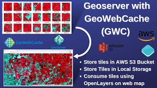
WebGIS: Create fast cached Web Map using Geoserver, GeoWebCache, & AWS (S3 Bucket) as storage medium by OpenGeo Lab 12,900 views 1 year ago 52 minutes
Geoserver: Publish Cloud Optimized GeoTIFF(COG) hosted on AWS S3 in Geoserver by OpenGeo Lab 2,718 views 2 years ago 15 minutes
Cloud Optimized GeoTIFF(COG):Create COG, Upload on AWS (S3) Bucket, Access through QGIS & OpenLayers by OpenGeo Lab 3,398 views 2 years ago 35 minutes
Google Earth Engine: Change detection analysis using near real-time Dynamic Global Land cover data by OpenGeo Lab 6,222 views 2 years ago 33 minutes
Python for Geospatial Analysis: Install Python, GeoPandas, GDAL and Rasterio library[using pip] by OpenGeo Lab 3,965 views 2 years ago 22 minutes
WebGIS Development: Create Raster Time series animation with Geoserver and OpenLayers by OpenGeo Lab 5,850 views 2 years ago 36 minutes
Flood Mapping using Sentinel-1 SAR data in Google Earth engine - Recent Assam flood by OpenGeo Lab 24,027 views 2 years ago 28 minutes
ESA 2020 Global Land Cover data (10m): Download and use in Google Earth engine by OpenGeo Lab 2,654 views 2 years ago 18 minutes
PyScript - Run Python in the Browser ! by OpenGeo Lab 786 views 2 years ago 19 minutes
Google Earth Engine -Spectral signature extraction from Sentinel-2 Data by OpenGeo Lab 4,920 views 2 years ago 22 minutes
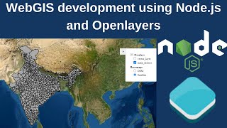
WebGIS development using Node.js and Openlayers by OpenGeo Lab 10,819 views 2 years ago 27 minutes
Google Earth Engine -Time Series NDVI Extraction from MODIS and Sentinel-2 Data by OpenGeo Lab 13,930 views 2 years ago 43 minutes
Google Earth Engine - Rice/Paddy Crop Classification using Sentinel-1 SAR data by OpenGeo Lab 15,532 views 2 years ago 1 hour
WebGIS Development from scratch using Openlayers/Leaflet & Geoserver with feature query capability by OpenGeo Lab 23,553 views 2 years ago 1 hour, 24 minutes
Google Earth Engine - Browse, Visualize and Download Landsat 9 data by OpenGeo Lab 1,868 views 2 years ago 29 minutes
COVID WebGIS development from scratch using openlayers, Postgis & JSP (without Geoserver) by OpenGeo Lab 10,937 views 2 years ago 1 hour, 37 minutes
Google Data Studio - Build interactive/dynamic Dashboard from Excel data by OpenGeo Lab 4,868 views 2 years ago 36 minutes
Excel Maps: Choropleth, 3D, Heat map and Time Series Animation by OpenGeo Lab 2,152 views 2 years ago 29 minutes
WebGIS dashboard without any programming/Coding using MapStore framework and Geoserver - part 2 by OpenGeo Lab 12,969 views 2 years ago 50 minutes
WebGIS application development without any programming using MapStore framework and Geoserver-part1 by OpenGeo Lab 17,482 views 2 years ago 27 minutes
Watching the Earth breathe: Seasonal Vegetation Time lapse for the last two decades (2000 to 2021) by OpenGeo Lab 650 views 2 years ago 1 minute, 33 seconds
Download Vegetation Health Products (VCI, TCI, VHI) derived from Satellite Remote Sensing data by OpenGeo Lab 3,670 views 2 years ago 20 minutes
How to Enable CORS in Geoserver and Tomcat (CORS Error Solution) by OpenGeo Lab 6,557 views 3 years ago 15 minutes
ESRI 2020 Land Cover data: Download and use in Google Earth engine by OpenGeo Lab 4,892 views 3 years ago 16 minutes
Create Fast cached Base Map like Google Map based on OSM data using Postgis, Geoserver & Tilecaching by OpenGeo Lab 18,360 views 3 years ago 1 hour, 8 minutes
Openlayers 6: Styling Vector data (Markers, Choropleth and Proportional Circles map on WebGIS) by OpenGeo Lab 7,130 views 3 years ago 56 minutes
Geoserver: Feature Editing on WebGIS using Geoserver(WFS-T service) and Openlayers by OpenGeo Lab 10,444 views 3 years ago 52 minutes
Recommended
5 Shirt Hacks Every Man Should Know
01:25
Clay Massage - New Spa Saloons Trend!
01:40
Lions Are Experts In Cars!
01:22
Slo Mo Guys Shatter a CD At 170,000FPS & It's Fantastic!
08:36
Aladdin: New Edition
04:08
Sushi? Yes, And The More The Better!
00:06
The World’s Cheapest Store & Where To Find It
15:49
365 Day Engagement: Best Marriage Proposal 2015
15:45
If Your Smartphone Was A Guy
03:59
Bread Buttle: Will The Rooster Surrender?
01:40


![Python for Geospatial Analysis: Install Python, GeoPandas, GDAL and Rasterio library[using pip] by OpenGeo Lab 3,965 views 2 years ago 22 minutes](https://i.ytimg.com/vi/Z4ySoDNm0ZI/mqdefault.jpg)