15 Free YouTube subscribers for your channel

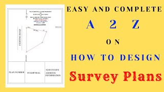
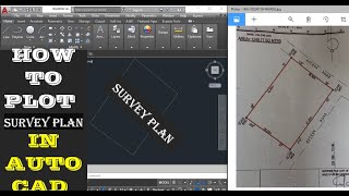
01 Plotting UTM Coordinates

In this video, you will learn how to plot/draw surveyed points whose grid/rectangular coordinates are known or calculated to make a survey site plan.
This is useful for plotting GPS coordinates to make a survey site plan of parcel of land.
http://UmarYusuf.com


Recommended