1. Introduction to ArcGIS| ArcGIS Bangla Tutorial

1. Introduction to ArcGIS| ArcGIS Bangla Tutorial
WRE Forum presents the Bangla Tutorial on ArcGIS by Afiya Narzis Anannya, Department of Environmental, Water Resources and Coastal Engineering (EWCE), Military Institute of Science and Technology (MIST).
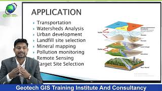
ArcGIS is a geographic information system (GIS) for working with maps and geographic information maintained by the Environmental Systems Research Institute (Esri).
In this five lectures, Afiya Narzis Anannya has tried to cover basic topics of ArcGIS.
The tutorial series consists of five videos. These are:
1. Introduction to ArcGIS
2. GIS Output
3. Map Design
4. Geo Processing
5. Table Operation
Other lectures will be published gradually. Stay tuned with WRE Forum.
© WRE Forum 2021