Grow your YouTube channel like a PRO with a free tool

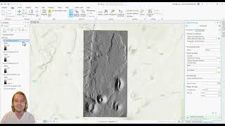
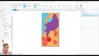
2 Understanding Geographic and Projected Coordinate Systems u0026 Projecting DEM in ArcGIS Pro
Welcome to this OpenTopography video tutorial playlist on how to use ArcGIS Pro software for geologic mapping! If you would like to download the SP_Mountain dataset and follow along with me you can access the files at this link:
https://drive.google.com/drive/folder...
In this video we discuss the differences between Geographic Coordinate Systems (GCS) and Projected Coordinate Systems (PCS). I will show you how to define coordinate systems in your mapping workspace, as well how to project a DEM into a different coordinate system.
https://opentopography.org/
OpenTopography facilitates community access to highresolution, Earth scienceoriented topography data and related tools and resources


Recommended