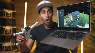
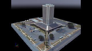
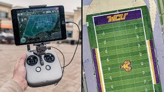
3D Modeling with Drones using PIX4Dmatic

This is how you can utilize a drone like the DJI Phantom 4 to produce 3D models of buildings. I also will show you the process of creating a point cloud and mesh using PIX4Dmatic.
Join The Survey School https://thesurveyschool.com/
Join me on Social Media:
Website: https://www.tamimi.biz
Facebook: / tamimibiz
Survey Shirts https://www.SurveyShirts.com
Private Facebook Group: / iamasurveyor
Instagram: / ramitamimi
LinkedIn: / ramitamimi
✉ Email: [email protected]
About Professor Rami Tamimi:
Rami Tamimi is an American doctorate student at The Ohio State University working towards his Doctor of Philosophy in Geodetic Engineering. With over 8 years of experience in the Land Development Industry, his experience revolves around traditional field surveying, civil design work using AutoCAD Civil 3D, and geospatial technology including LiDAR, SONOR, and Photogrammetric data acquisition and processing with the use of Unmanned Aircraft Systems or Drones. He is also a University Professor and creates instructional video content on YouTube.
#3DModeling #DroneModeling #pix4d