A Decade of Tsunami Warning System Sensor Network Upgrades

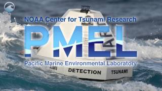
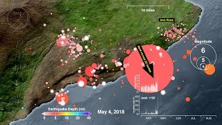
The bestknown tsunamidetection devices are the DART buoys. These buoys transmit data from their pressure sensors on the sea floor that measure tsunami waves passing over them. In 2004 we had only 8 DARTs, all in the Pacific Ocean. Today we use more than 60 DARTs worldwide.
In addition to DARTs we also measure tsunamis with sealevel gauges located on coastlines. In 2004 we received sealevel data from about 150 of these coastal gauges, mostly in and around the Pacific Ocean. Today we receive sealevel data from more than 600 coastal gauges worldwide.
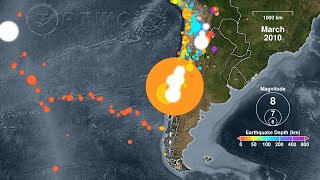
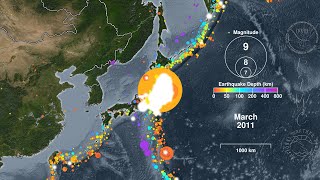
Long before we can measure a tsunami we can detect and locate the earthquake that caused it. Therefore we use a global network of seismometers to record earthquakes as they occur and determine their tsunamicausing potential in real time. In 2004 we analyzed seismic data from about 120 seismometers worldwide. Today we use more than 650 seismometers worldwide.
We can determine how these additional sensors have improved our performance using geospatial analysis techniques. If we treat the deepsea trenches as megathrust earthquake sources, we find that we can detect and locate a megathrust earthquake about 5 minutes faster in 2014 than we did in 2004.
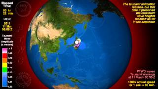
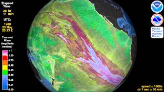
We can perform a similar analysis for our sealevel instruments. We find that on average we can detect and measure a tsunami with at least 3 sensors (DARTs and/or coastal gauges) about 2 hours faster in 2014 than we did in 2004. The improvement is even greater in the Indian Ocean and the Caribbean Sea.
In the years to come we will continue to add sensors to our network to further improve our tsunami warning capability.