A little secret to rock your YouTube subscribers

Agisoft Dense Cloud to Surpac 7.4.2 Point Cloud Processing in 5 Simple Steps | Aerial Surveying

In this Video we show you 5 very Quick Easy Steps to Upload a Point Cloud of almost 10 Million Points into Surpac, from Drone Mapping.
The Process starts from Agisoft Dense Cloud, is then Exported as an ASCII File, and easily transferred into Surpac for futher Processing.
This is a great Tool & Skill to know for Mining Surveyors or any other type of Surveyor that wants to know Measurements, Volumes, Movements of Earth in Mining and/or Construction.
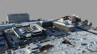
The Data was collected over a small Construction Site and Captured with a DJI Phantom 4 Pro V2.0.
Please Like and Subscribe to our Channel for more Content like this and please Visit our Website for more Content.
https://aerialsurveying.org/pointclo...


Recommended