Agisoft Metashape 2.1 presentation

New features in Agisoft Metashape 2.1
0:10 New features in Agisoft Metashape 2.1
0:31 Terrestrial laser scanning data support
0:54 Geometrybased alignment for terrestrial laser scans
1:18 Native aerial LiDAR data support
1:37 Aerial LiDAR point cloud smoothing and profile measurement
1:52 Cleaner surface reconstruction from LiDAR data with trajectory support
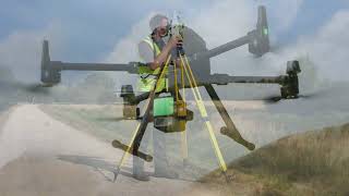
2:11 Mission planning for complex sites
2:30 Block models
2:54 Underwater imagery processing
3:09 Multispectral imagery processing
3:35 DEM editing tools
3:53 Automatic multiclass point cloud classification
4:11 Automatic imagebased powerlines detection
4:28 Vectorization instruments
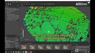
4:39 Distance and volume measurements
5:04 Stereoscopic measurements
5:19 Accelerated processing
5:44 Diffuse, normal, occlusion maps
6:16 Agisoft Cloud visualization, inspection, sharing and measurements
7:37 Free trial