Andean Highlands | Beban Pass | Sierra Valdivieso Circuit

For my map I downloaded “Sierra Valdivieso Circuit” from my AllTrails app. It is listed as a hard 27.5mi pointtopoint trail with 6,295ft of elevation gain. With the additional section of trail in this video the length will be approximately 33 miles (depending on your route when off trail)
Starting point on AllTrails is accurate and easy to find from the road. Follow the beginning of the trail listed on the trailhead map. Once you make it to the cabin the trail disappears and you will simply follow the general direction as shown on your map. If you’re experienced enough to be considering this trek then you are likely experienced enough to know how to navigate off trail and basic route planning, so you shouldn’t worry.
There is a campsite option available just before the Beban pass. It is directly next to water so if you are planning this then you don’t need to carry much water at all the first day. From here to route up the pass is unmarked but intuitive. When you reach the top skirt over and up the side to complete your final uphill for the day.
Continue down loose terrain following a milky white river and occasional cairns. The trees can get a bit thick at points so just maneuver your way through in whatever way feels natural. You will notice multiple campsite options from this point on. There are a few larger cleared spaces at the second of the sites listed as unofficial, the only problem is that these ones are not directly next to any major water source. If you choose to camp where we camped there are multiple smaller cleared spaces directly next to the large river and has a beautiful view of the waterfall.
Next you have the option to head over the Valdivieso pass or continue on as we did in the video and traverse 2 miles of fallen trees and rolling hills that are very difficult. Continuing on from the bay you could manage to camp at nearly every large body of water you encounter. My favorite one would be the same site used after making it over the Valdivieso pass.
Keep in mind that this section of the trail is almost non existent. There are occasionally trail markers but the majority of the time they don’t bring you back to a trail, they simply reassure you that you aren’t lost. This section is quite difficult due to the density of the trees, tall grasses, and elevation gain. Be sure to give yourself enough daylight to complete this section.
On the descent the trail is a bit easier to follow until you reach the first listed campsite. When we arrived everything was under water and fallen trees made this area extremely difficult to navigate. We continued in the general direction we needed to go hoping to find any flat dry area to set camp. On the map, just Southeast of the first campsite listed there is a river crossing and that is where we set camp.
About a mile from here the trail is relatively easy to follow. You spend most of your time in the marsh and occasional mud pits. Be EXTREMELY careful during this part to not walk over any areas that look like only mud. They may look shallow but they can be very deep. The one I fell in I never felt the bottom and I was up to my belly button in the mud. It took both of my friends pulling me out to escape.
We never found an official river crossing for the final stretch, but as you saw it wasn’t too deep. After you cross the river you are only half a mile from an extremely obvious trail that would be listed as easy on AllTrails
It was pretty easy to hitchhike back, or there were occasionally taxis that drove by as well, but this will likely depend on the time of day that you finish.
This entire trail you follow water, so you don’t need to carry
PLEASE always practice LNT. The untouched wilderness is what makes this trail as amazing as it is
The hostel offering a free night is abnormal and was a joke. Please don't expect this.
The shoes I used throughout my entire trek and while at camp:
https://xeroshoes.com/go/KathrynJones/
Follow along on my adventures in real time @kathrynmjones / kathrynmjones
For information on gear I use, and other outdoor tips and tricks check out my website: https://www.kathrynmjones.com
00:00 Free night?
01:11 Arriving at the trailhead
02:23 First pass
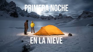
04:32 Arriving at camp
05:34 Campfire
06:16 Day 2
06:42 Plan with map
08:03 Start day 2
10:26 Trail info
10:58 Hiking 2nd half of day 2
12:20 Losing the trail
13:58 “Camp”
14:50 Good morning day 3
16:48 Quick sand mud
17:39 Last river crossing
18:47 Hitchhiking back
19:26 Recap
MUSIC:
DR777 MAJESTIC COLORMo Vibez X Creepa DR777 | Majestic Color
• Mo Vibez X Creepa DR777 | Majestic ...
SILVER CLOUDS MAJESTIC COLOR
FLYES Silver Clouds | Majestic Color
• FLYES Silver Clouds | Majestic Color
Lofi Mallet Kwon
Empire Seasons Dan Henig
TBH MAJESTIC COLOR
bonjr TBH | Majestic Color
• bonjr TBH | Majestic Color
SHOULDER CLOSURES Gunnar Olsen
• Shoulder Closures Gunnar Olsen
Snowy Peaks pt1 Chris Haugen