Animated Maps: 120 Years of Earthquakes (4K)

Be sure to watch this animated map fullscreen at 4K resolution!
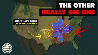
This animated map makes use of USGS data to map earthquake events with a magnitude of 6.0 and greater from 1900 to November 2019. The depths of the earthquakes have been exaggerated so we can actually see the relative depths of these events. This map also highlights several key earthquakes in the last 120 years, including the 1906 San Francisco (M7.9) earthquake, the Great Chilean Earthquake (M9.5) of 1960, and the more recent event that rocked Haiti (M7.1) in 2010.
This animated map was made using Esri's ArcGIS Pro, Cinema 4D, XParticles, Redshift, and Adobe After Effects. Please visit http://ow.ly/fm2950xgu0B for more information about ArcGIS Pro.
Data Source: https://www.usgs.gov/naturalhazards/...
Music: Continent by ANBR
Follow us on Social Media!
Twitter: / esri
Facebook: / esrigis
LinkedIn: / esri
Instagram: / esrigram
The Science of Where: http://www.esri.com