Grow your YouTube channel like a PRO with a free tool

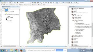
ArcGIS Clip Raster Tool

Video #34
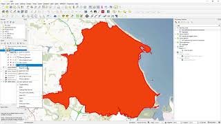
This quick video shows you how to clip a raster using Spatial Analyst extension in ArcMap 10.5. I use a layer containing 2 polygons to clip my raster dataset.
The extension is an additional cost to ArcGIS Desktop.
You can see the same functionality demonstrated in previous videos for MapInfo and QGIS.
Note you can add the Spatial Analyst extension (for 60 days evaluation) to your ArcMap using the ArcGIS Administrator


Recommended