ArcGIS Pro - Basic Intro to the ArcGIS Data Interoperability Extension

Video #68 (incorrectly marked as #67 in the video!)
This video is a brief overview of how the Data Interoperability Extension works. The extension, which is an additional license, allows the reading and writing of a large number of spatial formats. It uses FME from Safe Software and so this little tutorial will show that FME Desktop Workbench environment.
In the video:
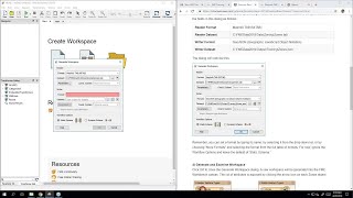
*I add a new tool to the project toolbox a Spatial ETL tool
*Use FME Workbench to create a new tool that reads a GeoRSS feed from BGS (UK earthquakes)
*Save it to the project
*Run the tool to create a shapefile as a standard geoprocessing tool
*Read the output shapefile into the project
*Click on some earthquake points to show the GeoRSS data
This is not a FME tutorial! I don't tidy up the workbench e.g. set coordsys, check for null geometry I just leave the workbench as it was created by FME. A single transformer is used GeometryFilter but thats not actually necessary as we know we will be reading point features only. But it is a good starter to get you going with the ArcGIS extension i.e. FME