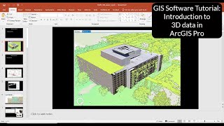
ArcGIS Pro: Create 3D Buildings from LiDAR

This Equator and ArcGIS Pro Tutorial guides you through how to create realistic 3D buildings using a LiDAR point cloud, or LAS file. Learn how import a LiDAR point cloud into ArcGIS pro, create and classify an LAS dataset, create raster files, create and edit polygon layers, create a multipatch layer and change the settings to create a realistic 3D scene.
Don't have a point cloud file (LAS or LAZ file)? Not a problem! Quickly and easily download one from Equator. Link to how to video here: • How to view a point cloud in Equator
Equator has an extensive collection of the latest LiDAR data available, so you can download your data and get started on your project immediately.
Get LiDAR data from Equator here: https://maps.equatorstudios.com/
Please like and subscribe.
Check us out on
Website: https://equatorstudios.com/
LinkedIn: / equatorstudios
YouTube: / @equatorstudios
Discord: / discord
Skills demonstrated in this video include:
In ArcGIS Pro: import point cloud file, Convert LAS tool, Create LAS Dataset tool, LAS Dataset Layer (Appearance, Data, Classification), LAS Point Statistics as Raster (creating a raster file or DEM from LiDAR point clouds), Raster to Polygons tool, Select Layer by Attribute tool, editing polygons, Regularize Building Footprint tool, and LAS Building Multipatch tool.
00:00 Intro
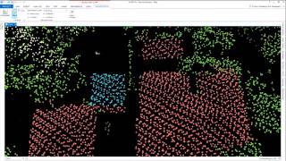
00:10 Source Point Cloud
00:30 Open ArcGIS, create new map, set up project
01:00 Convert LAS
01:44 Change Symbology in LAS Dataset Layer
02:24 Convert Scene to 2D Scene
02:47 LAS Point Statistics as Raster
03:53 Raster to Polygon
05:10 Select Layer by Attribute
05:48 Eliminate Polygon Part
06:23 Regularize Building Footprint
08:00 Edit polygons manually (Reshape and Edit Vertices)
09:43 Create DEM from Ground Points
11:20 LAS Building Multipatch
12:24 Change basemap to create realistic scene
Have more questions or want to learn more? Check out these other videos:
Where to find LiDAR data online: • Where to find LiDAR data online? (US...
How to download a point cloud from Equator: • How to view a point cloud in Equator
How to import an LAZ file into QGIS: • Importing a LAZ file into QGIS
Unsupervised Image Classification in QGIS: • Unsupervised Image Classification usi...
How to calculate the slope of a DEM in QGIS: • How to Calculate Slope of a DEM in QGIS
Music: Acoustic Breeze by Benjamin Tissot