Grow your YouTube views, likes and subscribers for free

ArcGIS Pro - Fishnet u0026 KDE

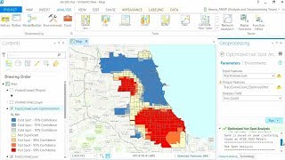
I go over how to create a fishnet grid over a boundary area the select by location to reduce the cell numbers. I provide another example of how to join points to polygons and display the counts. I then go into how to create a hotspot kernel density estimation for firearm related crimes in Little Rock.
KDE ESRI Link:
https://pro.arcgis.com/en/proapp/lat...
KDE Parameters (Hart & Zandbergen):
https://www.emerald.com/insight/conte...
Hot Spot Matrix (Ratcliffe):
https://www.researchgate.net/profile/...


Recommended