How to get free YouTube subscribers, likes and views?

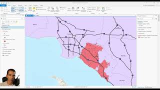
ArcGIS Pro: Generate Near Table to move offset crime points to street centerline

The video covers how to use the Generate Near Table to move the crime points that are offset to the street centerline. Once the Near Table is generated, display XY coordinates on the table. The FIDs allow for identification in the original files if you wanted to join/merge back in the crime and/or street data. From here you could get a count of violent crimes by street segment.


Recommended