ArcGIS: Supervised Classification

Software: ArcGIS 10.2.2
Landsat Satellite Image (TM 45)
Study Area: Dhaka Metropolitan Area (DMA), Bangladesh
Welcome to our YouTube tutorial where we dive into the fascinating world of geospatial analysis using ArcGIS 10.2.2 and Landsat satellite imagery. In this video, we focus on exploring the vibrant Dhaka Metropolitan Area (DMA) in Bangladesh, leveraging the powerful capabilities of ArcGIS and Landsat TM 45 imagery.
The Dhaka Metropolitan Area, one of the most populous and dynamic urban centers in the world, presents a unique landscape of rapid urbanization, environmental challenges, and socioeconomic complexities. Through the lens of Landsat satellite imagery, we embark on a journey to understand and analyze the spatial dynamics of this bustling metropolis.
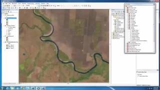
Our tutorial begins with an introduction to ArcGIS 10.2.2, a leading geographic information system (GIS) software renowned for its robust spatial analysis tools and intuitive interface. We guide you through the process of setting up your workspace and loading Landsat TM 45 imagery of the Dhaka Metropolitan Area.
With the imagery in hand, we delve into various techniques and workflows to extract valuable insights from the satellite data. From image enhancement and classification to change detection and land cover analysis, we demonstrate how ArcGIS empowers users to unravel the complexities of urban environments.
Throughout the tutorial, we highlight the significance of Landsat satellite imagery in monitoring land use changes, assessing urban expansion, and addressing environmental concerns in rapidly growing cities like Dhaka. By harnessing the rich spatial information captured by Landsat sensors, we gain a deeper understanding of the socioeconomic and environmental dynamics shaping the DMA landscape.
Whether you're a GIS enthusiast, a student exploring remote sensing applications, or a professional seeking to leverage geospatial data for urban planning and environmental management, this tutorial offers valuable insights and practical tips for analyzing satellite imagery in ArcGIS 10.2.2.
Join us on this enlightening journey as we unlock the potential of Landsat satellite imagery and ArcGIS tools to unravel the spatial intricacies of the Dhaka Metropolitan Area. Let's harness the power of geospatial analysis to make informed decisions and shape a sustainable future for urban environments worldwide.
Don't miss out on this exciting opportunity to explore the DMA from a whole new perspective. Subscribe to our channel, hit the like button, and stay tuned for more insightful tutorials on geospatial analysis, remote sensing, and GIS applications. Together, let's uncover the hidden treasures of our planet's landscapes using cuttingedge technology and spatial intelligence.