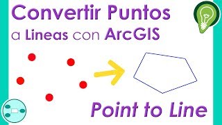
Automatically point to line generation

Construct line creates new line features at intervals along a selected point. For instance, you could use Construct line to place utility poles along an electric line. You also generate GPS point to line.
Donate To Help any Amount
https://www.paypal.com/paypalme/ramkh...
Process:
1Add data
2ArctoboxData management toolsFeaturesPoints to line double click(Select pole or point or you want to generate line) process...
3Split Line At Vertex Generated line select. process...
4Delete extra line.
Best cheapest price Laptop 2021 for GIS Use link given below :
(I am also using) : https://amzn.to/3LI6DSW
Pen Drive: https://amzn.to/3uXlBO8
Book Remote Sensing GIS and GPS for Beginners: https://amzn.to/3xgw2PA
Electrical Substation Engineering EHVHVDC & SFGIS: https://amzn.to/3DUOSwR
Project Based GIS Implementations: https://amzn.to/3DZ540m
Download data for exercise below:
https://bit.ly/3zvunUp
Digitization shape file automatically
• Digitization shape file automatically
Guidelines for Building data Capturization
• Guidelines for Building data Capturiz...
More Details :
WhatsApp Group Link:
https://bit.ly/3rJZvwm
Ram Khilawan,ram khilawan,ramkhilawan,ramkhelawan,ramkhilavan,
How to Add Legend on a Map Using ArcMap ArcGIS
Fix Topology error using ArcGIS
Arcgis File tools use, Import file, export file, Base map add, Map Create
Download and install ArcGis10.8 ,arcgis installation
geometric network vs utility network, Creating Geometric Networks, Network Analysis
House Front Elevation Designs |Simple Modern House Front Elevation Designs, Small House Design Idea
Feature to Point, Create Point features along a line in ArcGIS
How to use Spatial Adjustment ,How to use spatial adjustment tool in ArcGIS, Spatial adjustment ,
Change Projection Coordinate System in ArcMap,How to change Map Projections and Coordinate System
How to convert shapefile to geodatabase in ArcGIS,Importing Shapefiles Into a File Geodatabase
How to edit vertex in arcgis
Split line in ArcGIS, how to split line in ArcGIS, split a line into an equal number of new feature.
Trim Line in ArcGIS
How To Add Legend In ArcGIS
How To Edit legend In ArcGIS
ArcMap
Horizontal Legend
ArcGIS
ArcGIS error
How to solve ArcGIS error
ArcGIS desktop has encountered a serious application error
unable to continue
ArcGIS desktop
ArcGIS error solution
How to resolve ArcGIS error
ArcGIS desktop 10.3
ArcGIS desktop 10.5
arcgis install
how to install arcgis
installation of arcgis
how to reinstall arcgis
how to install arcgis desktop crack version
how to install arcgis crack
qgis
arcgis shapefile
how to download shapefile
arcgis jobs
arcgis kml to shapefile
kml
kml to layer
arcgis kriging
arcgis license manager
arcgis legend
how to add legend in arcgis
how to edit legend in arcgis
how to insert horizontal legend in arcgis
horizontal legend
horizontal legend in arcgis
multiple data frame in arcgis
how to add multiple data frame in arcgis
multiple data frame with single legend
how to add single legend for multiple data frame
how to export data in arcgis
exporting excel data into arcgis
how to add excel data into arcmap
how to interpolate in arcgis
interpolation in arcgis
how to interpolate excel data in arcgis
idw interpolation
error in arcgis
error
resolve error
resolve error in arcgis
error solution
how to introduce grid
how to introduce grid in arcgis
grid in arcmap
how to add grid in arcmap
how to add latitude longitude
lat long in arcgis
how to introduce lat long in arcgis
how to edit lat long in arcgis
arcgis basemap
drought
SPEI data
arcgis zoom to layer
arcgis 10.7
arcgis 10.6
arcgis 10.3 tutorial full
mapping with arcmap
map
arcgis 10.7 tutorial
google earth
georefferencing
digitization in arcgis
NDVI
erdas
arcgis 3d modelling
arcgis 3d analyst
arcgis download windows 7
arcgis download windows 10
arcgis crack installation
multiple maps
arcgis drawing
arcgis full tutorial
Edit vertex in ArcGIS,
How to edit vertices,
How to fix vertix,
Fix vertices in ArcGIS,
arc gis tutorial,
arcgis 10 tutorial,
arcgis 10.2 tutorial,
arcgis online tutorial,
arcgis tutorial,
arcgis tutorial video,
arcgis video tutorials,
georeferenced maps,
georeferenced pdf maps,
georeferencing,
georeferencing arcmap,
georeferencing in gis,
rms gis,
tutorial arcgis,
aerial remote sensing,
arc gis course,
arc gis program,
arc gis training,
arcgis,
arcgis arcmap,
arcgis online,
arcmap,
geography earth,
geospacial,
geospatial,
geospatial systems,
gis,
gis online tutorial,
gis software,
open source remote sensing software,
remote,
remote sensing meaning,
remote sensing training,
sensor,
what is a remote sensing,
what is remote sensing technology,
whats remote sensing,
g
arcgis help 10.2,
desktop editor,
gis editing,
gis editor,
how to create shapefile in arcgis,
topology arcgis,
arcgis arcmap,
arcgis clip,
arcgis data management tools,
arcgis mosaic,
arcgis spatial analyst,
clip arcgis,
clip raster arcgis,
data clip,
data management tools arcgis,