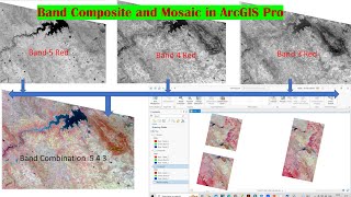
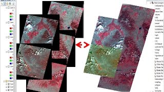
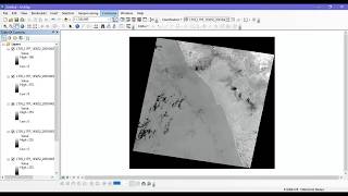
Band Composite and Extraction of AOI from Satellite Imagery using ArcGIS

Tutorial about how to composite band and Extraction of AOI from Satellite Imagery for further analysis.
Hope it will help you to composite band of Landsat Imagery and also to extract your area of interest (AOI) or study area from shape file and from satellite image.
Facebook Page: https://www.facebook.com/GISRSSolut...
Our others important Tutorial:
How to Download GIS Shapefile of any Country for free: • GIS Shapefile of any Country
Download update Shapefile (GIS) of any Area: • Shapefile download (Country, Road, Ri...
How to Create DEM and Contour by Google Earth & ArcGIS: • Extract Elevation/DEM and Contour fro...
Download Satellite Image from USGS website: • How to Download Satellite Image Lands...
Band Composite and Extraction of AOI from Satellite Imagery using ArcGIS: • Band Composite and Extraction of AOI ...
SAS PLANET very High Resolution free Google earth Image: • SAS PLANET: Download very High Resolu...
Easy way to Calculate Area, Perimeter and Length in ArcGIS: • Easy way to Calculate Area, Perimeter...
Related Tags
how to composite band of Landsat Image in ArcGIS
how to extract AOI from satellite image in ArcGIS
how to create composite band in ArcGIS
band composite and AOI extraction
Study area extraction from shapefile
Study area extraction from satellite image
Landsat image band composite
Thank you for watching. To get more videos, please subscribe my channel. Thank you.