Sub4Sub network gives free YouTube subscribers

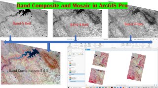
Band Composite in ArcGIS

This video illustrates the process of stacking layers of Liss III and other Satellites Image in ArcMap.Creates a single raster dataset from multiple bands.
#https://earthexplorer.usgs.gov/


Recommended