Basics of Creating Attribute Rules in ArcGIS Pro

Video contents:
00:11 Calculate field to generate code.
00:58 Summary tool to create a table showing the number of repeated values in a field (Summarize).
01:30 Create an Attribute Rule with a conditional statement When($feature.Field ==).
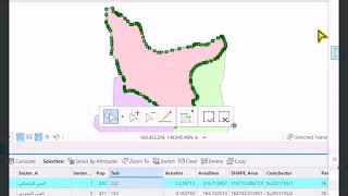
04:54 Create a code for land parcels.
05:54 Create an attribute rule on the code field for plots (Attribute Rule Code).
09:36 Move metadata spatially by creating Attribute Rule for Dynamic Data.
10:44 Code for transferring data using field names (Expression Code).
13:44 Try creating a new build with transferring the part number that contains the build (Create Feature).
14:40 Modify Expression Code.
15:35 Understanding writing data transfer code.
Study the feature rules to adjust metadata when entering and drawing features Create Attribute Rule:
• 12. قواعد السمات لضبط البيانات الوصفي...
Study the code for automatically transferring metadata by creating attribute rules Attribute Rule for Dynamic Data
• 25. كود نقل البيانات الوصفيه تلقائياً...
Attribute rules improve the editing experience and improve data integrity for geodatabase datasets. These are userdefined rules that can be used to automatically populate features, restrict invalid modifications during edits, and perform quality assurance checks on existing features.
Here are examples of how attribute rules can be used in a geodatabase:
To save time while editing, the values of the selected attributes (one or more fields) are automatically populated for newly created features, when a feature is updated, or when a feature is deleted. For example, new field values are entered when you create a feature based on an expression entered in the rule.
Fill in specific attribute values for features located at a userspecified time. For example, the full address field for existing features is populated by concatenating several text fields.
More than 50 exams on the ArcGIS Pro program through the following link:
https://bit.ly/ArcGISProQuizzes
GIS and ArcGIS Pro:
• شرح الـ GIS وبرنامج الـ ArcGIS Pro | ...
Working and interacting with ArcGIS Pro geographic data:
• التعامل والتفاعل مع البيانات الجغرافي...
Create and manage geographic data in ArcGIS Pro:
• أساسيات بناء وإدارة البيانات الجغرافي...
data analysis:
• تحليل البيانات الجغرافية الارك جي اي ...
Working and analyzing with 3D data:
• العمل والتحليل مع البيانات ثلاثية الأ...
To follow the GISforWE website here:
https://bit.ly/GISforWE
Lifetime ArcGIS Pro software download and readytolearn database:
https://gisforwe.blogspot.com/2022/11...
A website for everyone interested in the field of Geographic Information Systems (GIS) from here:
https://gisforwe.blogspot.com/
Here is a page and group on Facebook to learn more about Geographic Information Systems (GIS) and ArcGIS Pro programs through these links:
ArcGIS Pro Facebook group:
/ 486795389231905
GIS for WE ArcGIS Facebook group:
/ esri.arcgis
GIS for WE Facebook page:
https://www.facebook.com/profile.php?...
#ArcGISPro
#Analysis_GIS
#Data_Analysis
Prepared and presented by developer and researcher in the field of geographic information systems, Hossam Jaaba
Ramallah Palestine.
#GISforWE
GIS for World of ELearning