Grow your YouTube channel like a PRO with a free tool

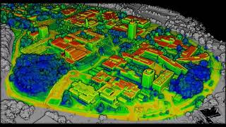
Binghamton Aerials to 3D

This was an exercise to take raw imagery collected as part of the New York State Orthoimagery (https://gis.ny.gov/orthoimagery) project and turn it into a 3D point cloud using Structure from Motion (Pix4Dmapper, in this case).


Recommended