Grow your YouTube channel like a PRO with a free tool

Calculating People Per 'idea' using Household Census data and ArcMAP

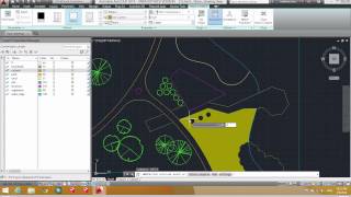
GIS is great to reveal an answer, in site selection for example, but it can also be used to generate information to validate sites selected by other means. In this video, I show you how to access Census blockgroup level population data and determine populations in a set distance from a potential site. In this case, the site is a proposed Apple Store in downtown Fargo