Calculating Water indices using ENVI and Landsat 8 Images (NDVI NDWI WRI AWEI)

Water indices are the topic of this video. At the end of the video, you'll be able to apply any water index to your images.
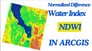
Accurate and frequent updates of surface water have been made possible by remote sensing technology. Index methods are mostly used for surface water estimation which separates the water from the background based on a threshold value. An index is generated by combining data from multiple spectral bands into a single value using Usually simple algebraic formulations.
in this video, not only do we show you the needed Preprocessing, but we also apply NDVI, NDWI, WRI, and AWEI (sh nsh) indices on Landsat 8 images in the ENVI software.
___________________________________________
Subscribe to our channel and Like the video:
✅ / @rsgis6997
_ _ _ _ _ _ _ _ _ _ _ _ _ _ _ _ _ _ _ _ _ _
Share the video with others:
✅ • Calculating Water indices using ENVI ...
=========================================================
Timeline:
00:00 Introduction
00:33 Landsat 8 Image
01:28 Radiometric Calibration
02:14 Atmospheric Correction
02:58 Surface Reflectance
04:45 Water Index
04:58 NDVI
05:41 NDWI
06:35 WRI
07:28 AWEI no shadow
09:17 AWEI Shadow
=========================================================
Calculating Water indices using ENVI and Landsat 8 Images (NDVI, NDWI, WRI, AWEI)
#rsandgis #gis #arcgistutorial #ENVI #Water #Water_index #Landsat #NDVI #NDWI #WRI #AWEI RS&GIS