Rock YouTube channel with real views, likes and subscribers

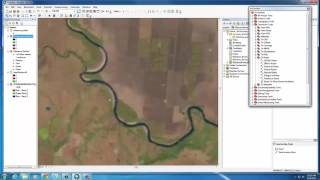
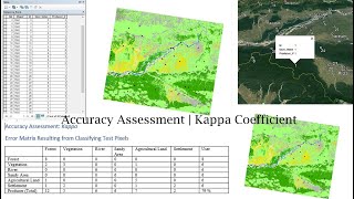
Classification Accuracy Assessment

In this session we will compare ground truth points with the land cover class value from our classified image. For each ground truth location, we know the true land cover...what is the predicted land cover for each ground truth location? We will arrange this information in a table with ground truth class in columns, predicted class in rows. This table is typically called an Error Matrix or a Classification Accuracy Table where the sum of cells along the diagonal represent the total ground truth points correctly classified.


Recommended