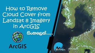
Cloud Masking of Landsat images in the Envi Software (Cloud Removal)

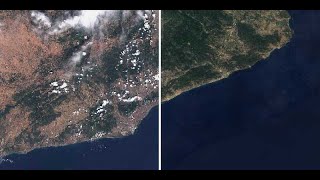
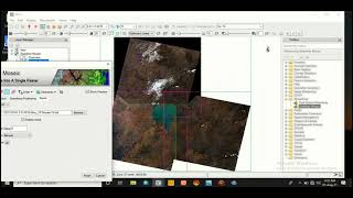
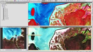
Clouds & their shadows on the satellite images reduce the visibility and decrease the reflection of objects making processing difficult and highly affecting the accuracy. so that the effects of clouds should be reduced from satellite images.it even becomes more important when it comes to image accuracy for processing that directly affects the results. A way to reduce the effects of the clouds in Remote sensing is "Masking". in this video we've shown how to Mask clouds from Landsat images readily. All the processing has been performed in the ENVI software which is one of the powerful software in this field. if you have any questions, you can leave a comment and ask your question.
_________________________________
Subscribe to our channel and Like the video:
✅ / channel
_ _ _ _ _ _ _ _ _ _ _ _ _ _ _ _ _ _ _ _ _ _
Share the video with others:
✅ • Cloud Masking of Landsat images in th...
_________________________________
Tags:
Cloud Masking of Landsat images in the Envi Software (Cloud Removal)
#Cloud_Masking #Landsat #Envi #Remote_sensing #GIS #Tutorial_Video #Landsat_8_Image #Landsat_8 RS & GIS #RSandGIS