Rock YouTube channel with real views, likes and subscribers

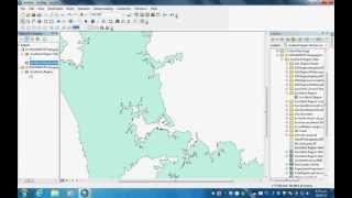
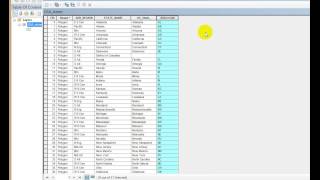
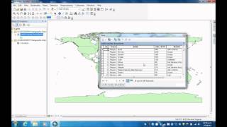
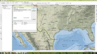
Converting a table of Lat / Long values into a Shapefile

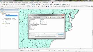
Jeff Blossom: stepbystep instructions for bringing tabular data (in an Excel spreadsheet) into ArcMap 10, and creating a points layer from x, y coordinates entered in the spreadsheet. The layer is then saved to a Shapefile for use in GIS.
CGA Training Module 1 Feb 2011


![How To Create A Powerful Point Of Sale (POS) Application In Excel [Full Training & Free Download]](https://i.ytimg.com/vi/C-jw10s8esw/mqdefault.jpg)


Recommended