Create 3D Map From Sentinel 2

This Video Help you how to Create 3D Map From Sentinel 2 with the helps of ALOS PALSAR DEM
Satellite Image (Sentinel 2) Download Link:
: https://earthexplorer.usgs.gov/
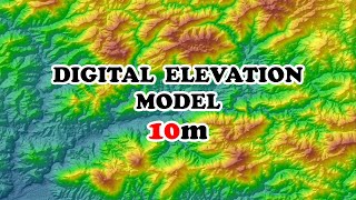
How to Download ALOS PALSAR RTC 12.5m DEM for Free
: • Download Free DEM 12.5 meters
Other Video:
1. Free: High Resolution Satellite Image 0.3m / 0.5m Download
: • Free High Resolution Satellite Image ...
2. Q GIS :ToA Reflectance Correction: ToA Radiance Correction: Atmospheric Correction : 2020
: • Radiometric Correction: RS&GIS new to...
3. Land Surface Temperature (LST) : Q GIS
: • Land Surface Temperature in QGIS 3
4. Radiometric correction in QGIS:
: • Radiometric correction in QGIS
5. Radiometric Correction with Raster Calculator in Qgis
: • Radiometric Correction in QGIS : Rast...
6. Georeferencing: Q GIS : Image to Image
: • Image to image georeferencing in QGIS
7. Georeferencing: Q GIS : Toposheet
: • How to Georeferencing in QGIS
Note:
1: https://www.usgs.gov/centers/eros/sci...
2: https://www.usgs.gov/landresources/n...
3. http://www.geotechcenter.org/uploads/...
4. http://gsp.humboldt.edu/OLM/Courses/G...
Also Thanks VLLO apps..
maXcel channel is all about GIS & Remote Sensing image processing, satellite image download using free or opensource Software like QGIS, SNAP and etc
Music by: https://www.bensound.com/royaltyfree...
#3D
#DEM
#Sentinel 2


![The moment we stopped understanding AI [AlexNet]](https://i.ytimg.com/vi/UZDiGooFs54/mqdefault.jpg)