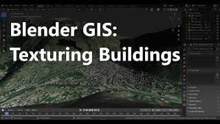
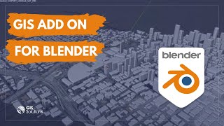
Create Accurate Maps with Blender GIS and QGIS

In this video we use QGIS and Blender GIS to import maps, heightmaps, and OSM data accurately into Blender.
QGIS:
https://www.qgis.org/en/site/forusers...
ESRI map service (XYZ tiles):
https://server.arcgisonline.com/ArcGI...
WKT Reference Text (enter your latitude and longitude):
PROJCS["Orthographic",
GEOGCS["GCS_WGS_1984",
DATUM["WGS_1984",
SPHEROID["WGS_1984",6378137,298.257223563]],
PRIMEM["Greenwich",0],
UNIT["Degree",0.0174532925199433]],
PROJECTION["Orthographic"],
PARAMETER["latitude_of_origin", ],
PARAMETER["central_meridian", ],
PARAMETER["false_easting",0],
PARAMETER["false_northing",0],
UNIT["Meter",1]]
Blender GIS:
https://github.com/domlysz/BlenderGIS
OpenTopography:
https://opentopography.org/
Tape Measure Model:
https://sketchfab.com/3dmodels/tape...
Earth Globe Model:
https://sketchfab.com/3dmodels/earth...