Free YouTube views likes and subscribers? Easily!

Create Interactive Elevation Profile in ArcGIS Pro

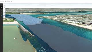
This video provides a stepbystep guide on how to effectively use the Elevation Profile tool to analyze terrain and landscape features in both 2D and 3D environments. Whether you're a GIS professional, urban planner, environmental scientist, or geospatial enthusiast, this tutorial will enhance your skills in topographic mapping and terrain analysis.


Recommended