Create Topographic Wetness Index TWI in ArcGIS

#viral #arcgis #topography #map
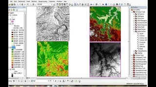
Topographic Wetness Index (TWI) is used to quantify topographic controls on hydrological processes. It is useful to measure or estimate where water will accumulate in an area with elevation differences. This video shows you how create Topographic Wetness Index (TWI) in ArcGIS. Enjoy your watching and subscribe.
For business and enquiries: WhatsApp+2347065365193 or Email: [email protected]
Twitter/X: / geojay_gis
Subscribe for more videos:
/ @geojaygissolution4856
00:00 Introduction
00:25 Data requirement and steps
00:55 Fill DEM
02:19 Flow direction
02:57 Flow accumulation
03:31 Calculate slope
04:20 Radian of slope
05:50 Tan slope
04:20 Radian of slope
07:35 Flow accumulation scaled
09:19 Topographic Wetness Index
11:25 Classify Topographic Wetness Index
12:04 Conclusion
Related videos
How To Download Topographic Map From Google Earth Pro: • How To Download Topographic Map From ...
Calculate NDVI using QGIS and Landsat 8 Images: • Calculate NDVI using QGIS and Landsat...
Calculate NDVI from Landsat image in ArcGIS: • Calculate NDVI from Landsat image in ...
How to calculate zonal statistics in ArcGIS: • How to calculate zonal statistics in ...
Calculate polygon area in QGIS: • Calculate Polygons Area in QGIS
Calculate area and percentage (%) in ArcGIS: • Calculate Area and Percentage (%) in ...
Area and Perimeter disabled Problem Solved in ArcGIS: • Area and Perimeter disabled Problem S...
How to calculate volume of water in lake or pond using ArcGIS: • How to calculate volume of water in l...
Calculate NDVI from Landsat image in ArcGIS: • Calculate NDVI from Landsat image in ...