Secret weapon how to promote your YouTube channel

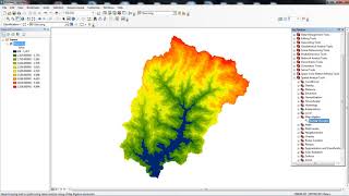
Creating a Slope and Aspect Map from a Digital Elevation Model in ArcGIS

The Slope tool calculates the maximum rate of change in value from that cell to its neighbors,
Aspect identifies the downslope direction of the maximum rate of change in value from each cell to its neighbors


Recommended