Secret sauce that brings YouTube followers, views, likes

Creating GeoJSON from Images - Casey Miller

Creating GeoJSON from Images Casey Miller
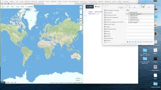
The resources we acquire containing paths, routes, and shapes often come in the form of images (JPG, PNG, etc.) or PDFs. While tools do exist to help with this process, such as Mapbox Studio dataset editor, I haven't come across many lightweight tools that will allow you to trace paths and generate GeoJSON all in one. I'm working on an open source tool for making this process easier and would love to show you all and get feedback on the tool!
This presentation was made at the 2022 annual meeting of the North American Cartographic Information Society (NACIS). For more information on NACIS, check out http://NACIS.org.


Recommended