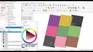
Destripe Landsat ETM+ Scan-Line Corrector error using QGIS

On May 31, 2003, the scanline corrector (SLC) for the ETM+ sensor aboard the Landsat 7 satellite failed permanently. Normally, the SLC compensates for the satellite's forward motion. Without an operating SLC, images have wedgeshaped gaps that range in width from a single pixel near the nadir point to about 12 pixels near the scene's edges.
Because of the SLC anomaly, approximately 22% of the pixels in these images are unscanned. The result of the SLC failure (known as the SLCoff problem) makes it difficult to use the Landsat 7 ETM+ data. To solve the SLCoff issue and enable continuous use of ETM+, we must find a suitable method for estimating the values at unscanned pixels.
This video shows how to destripe Landsat ETM+ image using QGIS.


![Time Series and Forecasting in R Programming [Video1] | Statistics Explained](https://i.ytimg.com/vi/OCGjGkfOPnk/mqdefault.jpg)