Detail Watershed Delineation using DEM in

Udemy course at ₹499 from (22 29 Oct 2022) Link: https://cutt.ly/qBMXjFu
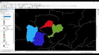
In this tutorial I am trying to give detail explanation on how to create watershed using DEM in ArcGIS easily
******************************************************************
You can CHECK this OUT !!
BUY Domain at Cheap Price!! : https://cutt.ly/5CEuzSD
GIS Work|| Best laptop at Low cost!!
Acer Predator Helios: https://amzn.to/3MzpjWM
ASUS TUF Gaming: https://amzn.to/3CwUpti
Lenovo Legion: https://amzn.to/3g87HEW
MSI Stealth: https://amzn.to/3CX9qWH
MSI GV15: https://amzn.to/3EHtSfM
Acer Nitro: https://amzn.to/3CBJLSh
******************************************************************
Course with Certificate at $9 only!
MS Excel Online Training https://cutt.ly/uBx2Pc1
****************************************************************
ArcGIS Tutorial: • Calculating Chlorophyll Index & Globa...
Qgis Tutorial: • Calculating SAVI MSAVI NDWI MNDWI I...
3D Electric Wire Calculation: • Calculating Electric Wire Length Cons...
Change Detection: • Hotspot / Kernel Density Analysis : C...
Download Free Shapefile : • Download GIS Shapefile Data ( Road, S...
Download Soil Organic Carbon, Evapotranspiration, Land cover, Precipitation Data: • How to Download Soil Organic Carbon E...
Human Influence Calculation: • Human Influence Calculation over Eco...
Lineaments Extraction and density Mapping: • Lineaments Extraction and density Ma...
World Soil Map Shapefile: • Download World Soil Map Shapefile
Hotspot / Kernel Density Analysis : • Hotspot / Kernel Density Analysis : C...
GIS Shapefile Data ( Road, Structure etc.) for Any Country: • Download GIS Shapefile Data ( Road, S...
Land Cover Change Detection in QGIS : • Land Cover Change Detection in QGIS P...
Soil Moisture Index and Land Surface Temperature Calculation: • Video
calculate normalized burn ratio (NBR): • How to calculate normalized burn rati...
Detail Watershed Delineation using DEM: • Detail Watershed Delineation using D...
Suitability Analysis Using Arcgis : Complete Project: • Suitability Analysis Using Arcgis : C...
Tags: how to create watershed in arcgis,watershed delineation arcgis pro,how to delineate a catchment area,watershed delineation using dem,how to create drainage map in arcgis,how to calculate catchment area in arcgis,watershed delineation,steps followed in the delineation of watersheds in gis pdf,watershed delineation steps in arcgis,delineating watersheds from a dem gis,watershed delineation procedure,how to use a dem to delineate a watershed/basin in arcgis
#ExploreTutorials #WatershedDelination #Arcgis