Digital elevation model | DEM | DSM | DTM | What is Digital elevation model

#Digitalelevationmodel #DEM #USMANGEO #earthscience
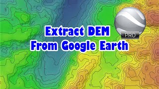
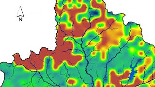
A digital elevation model (DEM) is a 3D computer graphics representation of elevation data to represent terrain, commonly of a planet (e.g. Earth), moon, or asteroid. A "global DEM" refers to a discrete global grid. DEMs are used often in geographic information systems, and are the most common basis for digitally produced relief maps.
While a digital surface model (DSM) may be useful for landscape modeling, city modeling and visualization applications, a digital terrain model (DTM) is often required for flood or drainage modeling, landuse studies,[1] geological applications, and other applications,[2] and in planetary science.
#GIS
GIS Open Course Ware | Geographic Information System
• GIS Open Course Ware | Geographic Inf...
Geological Orientation Data From Surfaces in ArcGIS |GIS analysis of geological surfaces orientation
• Geological Orientation Data From Surf...