Download Administrative Boundary of India For Free || Download Village Map || SOI Data || IT GIS

In this video, I'm covering the process of downloading administrative boundary of India from National level to Village level from Survey of India at zero cost. By these steps anyone can download shapefile/geodatabase of
1. Boundary of Villages
2. Boundary of Block/Taluk,
3. Boundary of District,
4. Boundary of State and
5. Boundary of India.
Please watch the video till the end.
For other videos on my channel:
+++++++++++++++++++++++++
QGIS Video Tutorials:
1. How to Download and Install the Latest Version of QGIS
• How to Download and Install the Lates...
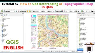
2. GCP to Image Georeferencing in QGIS
• GCP to Image Georeferencing in QGIS ...
3. Image to Image Georeferencing in QGIS
• Image to Image Georeferencing in QGI...
4. Digitization in point, line, and Polygon in QGIS
• Digitization in QGIS || Digitization ...
5. Advance Digitization Technique and Calculate Area in QGIS
• Advance Digitization in QGIS 3.14 || ...
6. Join Attribute Table in QGIS
• Table Joining in QGIS || Join Attribu...
7. Data Exploration Using QGIS 3.18
• Data Exploration Using QGIS 3.18 ||So...
8. Spatial Query in QGIS
• Spatial Query in QGIS 3.18 || Data Qu...
9. Attribute Query in QGIS 3.18
• Attribute Query in QGIS 3.18 || Conce...
10. Data Representation in Bar & PieChart on QGIS
• Bar & Pie Chart in QGIS || Data Repre...
11. How to Prepare Choropleth Map in QGIS
• How to Prepare Choropleth Map in QGIS...
12. Map Preparation and Map Composition in QGIS
• Map Preparation and Map Composition i...
13. Layer Stack or Marge in QGIS
• Layer Stack or Marge in QGIS || Marge...
14. Merge and Clip in QGIS 3.14
• Merge and Clip in QGIS 3.14 || Subset...
15. How to Install Plugins in QGIS || Install Semiautomatic Classification Plugin
• How to Install Plugins in QGIS || Ins...
16. Supervised Image Classification in QGIS
• Supervised Image Classification in QG...
17. Digitization on Google Earth
• Digitization on Google Earth || Downl...
18. Export to KML in QGIS 3.16
• Export to KML in QGIS 3.16 || KML to ...
Download and Installation:
1. Download Topographic Map from Survey of India
• Download Toposheet from SOI || Downlo...
2. Download Satellite Images from USGS For Free
• Download Landsat Images For Free || D...
3. Download LISSIII & DEM Image from Bhuvan
• Download LISSIII & DEM Image From Bh...
ArcGIS Video Tutorials:
1. Image to Image Georeferencing in ArcGIS 10.5
• Image to Image Georeferencing in ArcG...
2. How to Convert KML File into Shapefile
• KML to SHP Conversion in ArcGIS || Ho...
3. How to Change Projection in ArcGIS
• KML to SHP Conversion in ArcGIS || Ho...
4. How to Clip in ArcGIS
• Clip In ArcGIS || How to Subset in Ar...
5. How to Add a Google Earth Extension in ArcGIS || Export to KML Extension
• How to Add a Google Earth Extension i...
6. Assign a Shortcut Key in ArcGIS
• Video
7. Split Features in ArcGIS
• Split Features in ArcGIS || Split Pol...
8. Split by Attribute in ArcGIS
• Split By Attribute in ArcGIS || Split...
ERDAS IMAGINE Video Tutorials
1. Layer Stacking in ERDAS Imagine 14
• Layer Stacking in ERDAS Imagine 14 ||...
2. Subset in ERDAS Imagine
• Video
#AdministrativeBoundary #VillageBoundary #SurveyOfIndia #DownloadShapefile
#DownloadVillageMap #DownloadBlockShapefile #DownloadSOI #SOI #Toposheet #ITGIS #Itgis
If you have any queries please comment below.
If you like my videos please subscribe to my channel for the latest update.
Don't forget to Like, Share or Comment.
Thanks for watching it.