Download ASTER DEM Data for Free | Step by Step Tutorial 🛰️🗻

Hi,
Welcome to Dawn of Geospatial World. Where you can learn about GIS, Remote sensing, Satellite Imageries.
About this Video
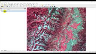
In this stepbystep tutorial, we'll show you how to download ASTER DEM data for free. ASTER (Advanced Spaceborne Thermal Emission and Reflection Radiometer) is a satellitebased mission that provides highquality elevation data, making it a valuable resource for a wide range of applications, including geographic information systems (GIS), geological analysis, and topographic mapping.
Here are some specifications of the ASTER satellite:
Launch date: December 18, 1999
Orbit altitude: 705 km
Orbit inclination: 98.2 degrees
Spatial resolution: 1590 meters for visible and nearinfrared (VNIR) bands, and 90 meters for thermal infrared (TIR) bands
Spectral bands: 14 bands ranging from visible to thermal infrared (VNIR: 3 bands, SWIR: 6 bands, TIR: 5 bands)
Swath width: 60 km
Revisit time: 16 days (for global coverage)
Mission life: 5 years (extended to more than 20 years with ongoing operations)
Instrument: Advanced Spaceborne Thermal Emission and Reflection Radiometer (ASTER)
Agency: NASA and Japan's Ministry of Economy, Trade, and Industry (METI)
During this tutorial, we'll cover everything you need to know to download ASTER DEM data for free, including the software you'll need to access the data and where to find the download links. We'll walk you through the entire process, from navigating the NASA EarthData website to selecting the right data for your project and downloading it to your computer.
Whether you're a GIS professional, geologist, or student looking to explore elevation data, this tutorial will help you get started with ASTER DEM data without spending a dime. Don't miss out on this valuable resource – follow along with our tutorial and start exploring the world of ASTER DEM data today!
NASA EarthData: https://www.earthdata.nasa.gov/
Various Space Agencies & Missions: • Space Agencies & Earth Observing Miss...
Data Download Processes for GIS Work: • Download Data for GIS & Remote Sensin...
#dawnofgeospatialworld #gis #gis2023 #remotesensing #elevation #datadownload #dataset #aster #nasa #qgis #arcmap #tutorial #education #earthdata #usgs #dem
The following geospatial and environmental solutions video instruction is available on this channel:
ArcGIS, QGIS (Geospatial Analysis, Monitoring)
Cartography
Basics of Mapmaking
Basics of GIS & Remote Sensing
Google Earth Engine
You can watch our videos on YouTube : @dawnofgeospatialworld
If you think they're useful, kindly subscribe to our channel.
Follow us on Instagram : / dogw_official
Join our Facebook Group : / dogw.official
Thank you So Much.....