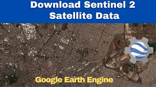
Download Cloud-filtered Sentinel 2 Imagery for Any district Using Global Administrative data

Unlock the power of Sentinel2 imagery for precise and cloudfiltered satellite images of any district worldwide with our stepbystep guide! This video will walk you through an efficient script to filter, process, and export Sentinel2 imagery tailored to your area of interest using Google Earth Engine.
First, we import and set up the necessary datasets. We use the Global Administrative Unit Layers (GAUL) for administrative boundaries and the Sentinel2 Surface Reflectance (Harmonized) collection for highquality satellite images. Next, we filter the administrative boundaries to select your district of interest. In this example, we focus on Chennai. We define the geometry of the selected district and center our map view for a clear perspective.
We create a median composite image from the filtered collection to minimize cloud cover effects. This composite is then clipped to the boundaries of the selected district, providing a precise and clear image of the area of interest. Finally, we add the processed image to the map for visualization and export it to Google Drive. The exported image is in high resolution, ready for further analysis or integration into your projects.
Code link:
https://code.earthengine.google.com/7...
Resources:
Sentinel 2A image collection: https://developers.google.com/earthe...
Global Administrative Unit Layers 2015, SecondLevel Administrative: https://developers.google.com/earthe...
Whether you're working on environmental monitoring, urban planning, or agricultural assessments, this tutorial equips you with the tools to obtain highquality satellite imagery tailored to your needs.
Join us and learn how to harness the power of Sentinel2 imagery for any district in the world!.
Join Membership to get access to perks & Support us
/ @terraspatial
Join the Terra Spatial Community:
Engage with fellow learners, share your experiences, and get support on our dedicated community forum.
Stay connected:
Subscribe to our Channel: / @terraspatial. .
Facebook: / terraspatial
Geosuite blog: https://geosuite.blogspot.com/
**Don't forget to Like, Share, and Subscribe for more insightful tutorials! ✨
#remotesensing #sentinel2 #googleearthengine #cloudfilter #clip #satelliteimagery #GIS #geospatialanalysis #environmentalmonitoring #urbanplanning #agriculture


![Form, Function, & Fun! My Obsidian Vault Tour [2024]](https://i.ytimg.com/vi/rAkerV8rlow/mqdefault.jpg)
![The moment we stopped understanding AI [AlexNet]](https://i.ytimg.com/vi/UZDiGooFs54/mqdefault.jpg)