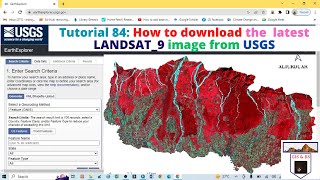
Download Landsat 9 images from EarthExplorer / USGS

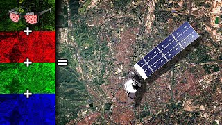
In this video tutorial you will learn how to download Landsat 9 images from EarthExplorer USGS. Download Landsat 9 images for free, from EarthExplorer USGS. I had shown how to download landsat 9 collection 2 and Level 2. Bands available in collection 2 & level 2 are Ultra blue, Blue, Green, Red, NIR, SWIR 1, SWIR 2, Thermal Band 10. For Downloading Band 8 and Band 12 use Collection 2 & Level 1.
Earth Explorer:
https://earthexplorer.usgs.gov/
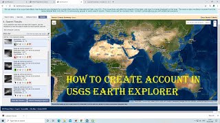
Creating Account in EarthExplorer (Tutorial):
• How to Create Account in EarthExplore...
Band Details of Landsat 9:
https://www.satimagingcorp.com/satell...
Downloading Landsat 8 (Tutorial): • Download Landsat 8 images from EarthE...
Downloading SRTM DEM (Tutorial): • Downloading 30m SRTM DEM data from US...
#landsat
#landsat9
#downloadlandsat9
#earthexplorer
#usgs
00:00 Introduction
00:30 Visiting EarthExplorer Website
00:48 Login
01:04 Overview of Landsat 9 Bands & Resolution
02:03 Defining / Searching Study Area for Data Download
03:21 Filtering Results Data, Cloud Cover and Results per page
04:25 Selecting Landsat 9 Data Datasets
05:01 Additional Criteria
05:28 View of Landsat 9 images
06:56 View of Meta data
07:00 Download Landsat 9 image
08:52 Extracting the Bands
10:01 Important Information
10:22 View Landsat 9 images in ArcGIS
10:26 Adding Data to ArcGIS
11:11 Layer stack / Composite Band in ArcGIS
11:45 View of Downloaded images in ArcGIS
12:00 Thanks / Please Subscribe