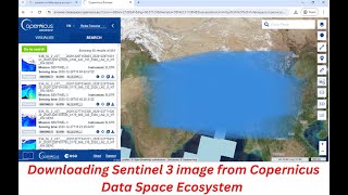
Download Sentinel-1 SAR DATA From Copernicus Data Space Ecosystem | Latest Update

You will learn how to download sentinel1 images from Copernicus Data Space Ecosystem for free in this video. I hope this video will help you to enhance your knowledge in GIS and Remote Sensing even more. The Sentinel1 images are very essential and this video will help you to download the images for free.
Link: https://sentinels.copernicus.eu/web/s...
The Sentinel1 mission is the European Radar Observatory for the Copernicus joint initiative of the European Commission (EC) and the European Space Agency (ESA). Copernicus is a European initiative for the implementation of information services dealing with environment and security. It is based on observation data received from Earth Observation satellites and groundbased information. The Sentinel1 mission includes Cband imaging operating in four exclusive imaging modes with different resolution (down to 5 m) and coverage (up to 400 km). It provides dual polarization capability, short revisit times and rapid product delivery. Additionally, precise measurements of spacecraft position and attitude are available for every observation.
Synthetic Aperture Radar (SAR) has the advantage of operating at wavelengths that are not affected by cloud cover or lack of illumination, allowing it to acquire data over a site during both day and night time, and under all weather conditions. The CSAR instrument of Sentinel1 provides reliable and repeated wide area monitoring. The mission consists of a constellation of two satellites, Sentinel1A and Sentinel1B, sharing the same orbital plane. Unfortunately, Sentinel1B experienced a power failure on December 23, 2021, and is no longer operational. It will be replaced in 2023 by Sentinel1C, whose data will be accessible through this ecosystem. Sentinel1 is designed to work in a preprogrammed, conflictfree operation mode. It captures highresolution images of all landmasses, coastal zones, and shipping routes worldwide, and provides vignettes of the global ocean. This ensures the reliability of service required by operational services and ensures a consistent longterm data archive for applications based on long time series.
For more videos related to GIS, Remote Sensing, Geoinformation Science and Climate change please watch videos of @EARTHGISensing. Please do not forget to like, comment and subscribe to @EARTHGISensing.
#download #sentinel1 #sardata #images #2024 #from #copernicusdataspaceecosystem #satelliteimages #radarimages