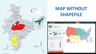
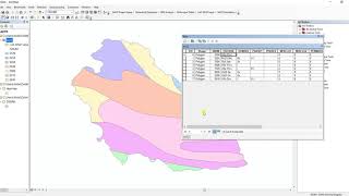
Download Soil data and Prepare Soil Type Map in ArcGIS

Hello and welcome everyone to GIS and RS Solution channel. Today we're here with a brandnew tutorial regarding how to download world soil data in several format like ESRI shapefile, ERDAS, IDRISI and other as well. Following this video, you will be able to prepare soil type map of any location of the world. I hope you will enjoy this video. We have tried our best to make it as easy as we can. So, Let’s have a cup of tea and stay with us till the end.
Soil type download link: http://www.fao.org/geonetwork/srv/en/...
Hope you enjoyed todays video. If you do so, please consider subscribing this channel and give a like and share with your fellows. You can also write in the comment section which type of GIS and remote sensing tutorial you needed. I will try to prepare and upload as per your requirements. Bye today and meet you in the next video. Stay safe and stay cool. Thank you for being with us.
related tags: soil type, soil classification, download soil data, how to download soil type data, how to download soil classification data, how to prepare soil map in arcgis, soil classification map in arcgis, soil classification map, soil type map in arcgis, soil classification in arcgis, soil map in Bangladesh