Download Very High Resolution Google Earth Image//Georeferencing in ArcGIS

Learn to download an image from google earth for ArcGIS
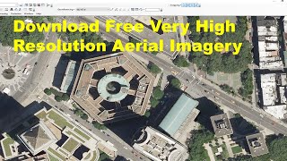
Download Free Very High Aerial Imagery 0.5 meter, SRTM DEM,sentinel2, Hyperion, LANDSAT8 & Aster
• Download Free Very High Aerial Imager...
How to calculate land surface temperature from Landsat 8 Satellite Data
• How to calculate land surface tempera...
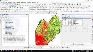
How to Create LULC using ArcGIS/ Supervised Classification
• How to Create LULC using ArcGIS/ Supe...
How to Create coronavirus Map in ArcGIS !! Health GIS
• How to Create coronavirus Map in ArcG...
Generate Contours and Slope From Google Earth in ArcGis
• Generate Contours and Slope From Goog...
How to delineate watershed using DEM
• How to delineate watershed using DEM
Digitization in Arc GIS
• Digitization in Arc GIS
georeferencing and projection
• georeferencing and projection
Download Very High Resolution Google Earth Image//Georeferencing in ArcGIS
• Download Very High Resolution Google ...
Email:[email protected]