Drone Surveying for Beginners

Join The Survey School https://thesurveyschool.com/
Survey Shirts https://www.SurveyShirts.com
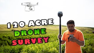
Surveying with Drones for Beginners. We will cover the fundamentals of drone mapping. Using ground control points (GCP) and check points (CHK) to make sure our aerial mapping project has survey grade accuracy.
Chapters:
0:00 Intro
1:40 What are Ground Control & Check Points
5:04 Setting GCPs and CHKs
7:20 Setting up the Drone
11:38 Flying the Drone
13:04 Outro
E38 Survey Solutions https://e38surveysolutions.com/collec...
Emlid Store https://store.emlid.com/rami
Join me on Social Media:
Website: https://www.tamimi.biz
Facebook: / tamimibiz
Private Facebook Group: / iamasurveyor
Instagram: / ramitamimi
LinkedIn: / ramitamimi
✉ Email: [email protected]
About Professor Rami Tamimi:
Rami Tamimi is an American doctorate student at The Ohio State University working towards his Doctor of Philosophy in Geodetic Engineering. With over 8 years of experience in the Land Development Industry, his experience revolves around traditional field surveying, civil design work using AutoCAD Civil 3D, and geospatial technology including LiDAR, SONOR, and Photogrammetric data acquisition and processing with the use of Unmanned Aircraft Systems or Drones. He is also a University Professor and creates instructional video content on YouTube.
#Surveying #Drones #DJI