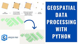
DTM Data Download in ArcGIS Pro

Downloading Digital Terrain Model (DTM) data from the OpenTopography API based on specified geographic locations or bounding boxes.
✅ Code algorithm:
Retrieve DTM Data: Utilize the OpenTopography API to fetch DTM data.
Process Feature Bounds: Transform feature bounds to a Polygon object for API requests.
Download and Save DTM Files: Save fetched DTM data to your specified output folder
Requirements:
Python 3.x
Packages: requests, geopandas, os
An API code obtained from OpenTopography. Don't have one? Sign up for free on their website to get it!
OpenTopography website
https://lnkd.in/dHQ69yQY
GitHub Repository Files:
OpenTopoDTMDownloader.py: Main Python script file.
README.md: Instructions on usage and requirements.
how_to_run_the_code.mp4: Video demonstrating how to run the code.
GitHub Repository Link:
https://bit.ly/43CsvsV
Thanks and credit to Mohamed Mokashifi
Thanks for watching it.
Please like, share, and subscribe to this channel.
YouTube: / 7startech95
Facebook: / 7startech95
Instagram: / 7startech95
Twitter: / 7startech95
Blog: https://www.7startech95.blogspot.com
LinkedIn: / 7startech95
Contact us at:
[email protected]
#gis #arcgispro #dtm #opentopography #7startech95


![The moment we stopped understanding AI [AlexNet]](https://i.ytimg.com/vi/UZDiGooFs54/mqdefault.jpg)