Earthquakes of the Caribbean: 1918 - 2019

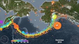
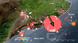
The M6.0 earthquake that occurred near Puerto Rico on September 24, 2019, was the largest earthquake to strike the U.S. territory in five years. It was not, however, the largest recorded earthquake there. That distinction goes to the July 7, 1943, M7.7 earthquake that thankfully did not generate a tsunami. Other earthquakes, and sometimes the landslides they cause, have produced tsunamis throughout the Caribbean Sea region, including one in Puerto Rico in 1918. Therefore this animation begins in 1918 and covers the 101 years up until the present day to show all of the recorded seismic activity in this region over that time period.*
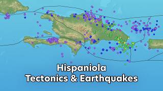
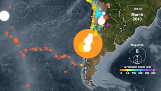
The Caribbean Sea lies over the Caribbean Plate, a section of the earth’s crust bounded by active faults separating it from other tectonic plates. These other plates include the North American Plate to the north and east and the Pacific Plate to the west. Relative motions between these plates cause earthquakes at their boundaries. Most of the eastwest trending boundaries are “strikeslip” or transform faults such that the plates move past each other horizontally, similar to the famous San Andreas Fault in California. Since they move sideways they do not generally cause earthquakes that move the ocean water above them, though they can trigger landslides that generate tsunamis, such as in Haiti in 2010. But the boundaries of the Caribbean Plate that run northwestsoutheast in Central America and the Leeward Islands are subduction zones, a type of plate boundary that can produce megathrust earthquakes with large vertical motions that can cause devastating tsunamis, such as the pair of devastating Dominican Republic earthquakes in 1946.
Some earthquakes in this region that produced significant tsunamis include:
Oct 11, 1919 M7.1 Puerto Rico (tsunami killed 140)
Aug 5, 1946 M7.5 Dominican Republic (tsunami killed 1790)
Aug 8, 1946 M7.0 Dominican Republic (tsunami killed 75)
Apr 22, 1991 M 7.6 Costa Rica (tsunami killed 3)
Sep 2, 1992 M7.7 Nicragua (tsunami killed 170 on the Pacific coast)
Jan 12, 2010 M7.0 Haiti (tsunami killed 7)
Aug 27, 2012 M7.3 El Salvador (Pacific Coast, no deaths)
Today the Pacific Tsunami Warning Center (PTWC) will issue tsunami alerts for any potentially tsunamicausing earthquake in the Caribbean region. These will be posted to:
https://tsunami.gov
For more information about mitigating tsunami hazards in this region please see the Caribbean Tsunami Warning Program (CTWP):
https://www.weather.gov/ctwp/
Earthquake Data Source: United States Geological Survey (USGS)/National Earthquake Information Center (NEIC) searchable catalog:
https://earthquake.usgs.gov/earthquak...
*Please note that this animation shows every earthquake in the USGS/NEIC catalog for this region. As the animation moves forward in time so too does the science of seismology with the continual addition of newer and better instruments. As the animation approaches the present day these instrument networks are able to detect smaller and smaller earthquakes, creating the illusion of increasing activity. This effect is especially noticeable starting in 1973, and in Puerto Rico in particular starting in the mid1990s. In reality these smaller earthquakes have always occurred, but the technology has only recently been able to detect them.