Earth's Landforms – Plateaus and Canyons

#landforms #canyons #plateaus
https://ngscience.com
Canyons, also called gorges, are deep, narrow channels that run between steep mountains or cliffs. Canyons are created by weathering and erosion of uplifted sedimentary rock caused by a river running through it. The formation of canyons usually takes millions of years. Scientists believe the Grand Canyon in the United States took between five to six million years to form.
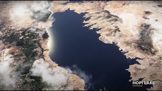
A plateau, also called a high plain or tableland, is flat terrain that elevates sharply from the surrounding land on at least one edge. Plateaus are often formed by the erosion of the surrounding area, leaving part of the terrain above ground surrounded by steep ledges. Plateaus can also be formed by volcanic activity.
The Tibetan Plateau in the Himalayas is Earth’s highest and largest plateau. It covers an area of 2.5 million kilometers (970,000 sq mi) and has an average elevation of about 4,500 meters (14,800 ft).
The Colca Canyon in southern Peru is formed by the erosion of volcanic rock caused by the Colca River. With a depth of over 3,270 meters (10,730 ft), it is one of the deepest canyons on Earth.
Shaping the Earth’s Surface
Over millions of years, forces and processes have been continually shaping the surface of the Earth and they continue to do so today. Some processes occur too slowly for us to notice from day to day. The Grand Canyon in the United States has been forming over millions of years by the weathering, erosion and deposition caused by the Colorado River running through it.
Denali, the highest mountain peak in the USA, has also been forming over millions of years. It rises above the ground around it due to the pressure caused by the movement of tectonic plates beneath it.
Other forces and processes, like a volcanic eruption or earthquake, change the Earth’s surface almost instantly.
The combination of these rapid and slow changes have shaped the Earth’s surface into physical features called landforms. Mountains, plains, valleys, canyons and plateaus are some examples of landforms.
Mountains
A mountain is a landform that rises above the surrounding land. A mountain is taller than a hill and usually has steep slopes and a sharp or rounded peak. There are three main types of mountains that differ in how they formed.
Volcanic mountains are formed when magma pushes up from beneath the Earth’s surface. When the magma reaches the surface, it creates a volcanic mountain. The mountains can get larger and taller when larva cools during volcanic eruptions. Mount Fuji in Japan is an example of a volcanic mountain.
Fold mountains are created when two or more of Earth’s tectonic plates are pressed together. The force pushes sedimentary rock upwards into a series of bends and folds. The tallest mountain range on the Earth, the Himalayas, are an example of fold mountains.
Block mountains are formed by the movement of the Earth’s crust along cracks called faults. The movement causes the Earth to pull apart and break into large chunks of rock. Some rocks are pushed upwards, forming mountains. The Sierra Nevada mountain range in the Western United States are block mountains.
Other planets in our solar system have mountains too. The tallest mountain, Olympus Mons, can be found on Mars. It is a volcanic mountain with a height of about 21 kilometers (13.6 miles). That’s about two and a half times taller than Earth’s tallest mountain, Mount Everest.
Plains and Valleys
At the base of many mountains are plains and valleys. Plains are wide, flat expanses of land with little change in elevation. Plains are generally in lowlying areas, but can also form on plateaus. Plains that extend from land to the ocean are called coastal plains. The size of plains can vary between a few hectares to hundreds of thousands of square kilometers. Being wide and flat also make plains suitable for agriculture and livestock farming. Many plains were formed over time by the erosion of the land from nearby hills or mountains. Other plains were formed by deposition of sediment by water or wind.
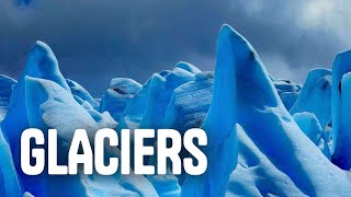
Like plains, valleys are lowlying areas, often between mountains or hills. Water may flow through a valley as streams or rivers. Some valleys are caused by the weathering and erosion of glaciers and have a ushape. Others are formed by running water such as a river or stream and have a sharper vshape.
A plain adjacent to a source of water such as a lake or river can be flooded when the water level is high. Called floodplains, these landforms are rich in diversity. Many organisms are attracted to floodplains when water releases nutrients into the soil.