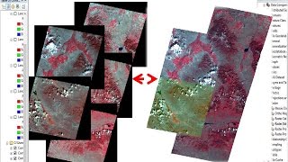
Erdas Tutorial - 11 || Seamless Color Balancing Mosaic of Satellite Image in Erdas || Sentinel 2

Erdas Tutorial 11 || Seamless Color Balancing Mosaic of Satellite Image in Erdas || Sentinel 2
If you like this types of learning GIS and Remote Sensing related Video
Please subscribe my channel and press the bell Icon and get all notification
Which types of do you want please comment, I will try to prepared that video and show you
If you like the video please like.... Comment.......
More Tutorial Videos:
Erdas Tutorial 10 || Resample or Resize of Satellite Image in Erdas ||
• Erdas Tutorial 10 || Resample or Re...
QGIS tutorial Create Slope, Hillshade, Aspect & contour using DEM || Analysis Tools | QGIS 3.14.15
• QGIS tutorial Create Slope, Hillsha...
How to Install QGIS Update Version without uninstall Previous Version
• How to Install QGIS Update Version wi...
QGIS Tutorial Field Name Edit, New Field Create & Delete Field of Shape file in QGIS
• QGIS Tutorial Field Name Edit, New ...
QGIS Tutorial Centroid Point & Vertices Extraction of Shape file || Geometry Tools ||
• QGIS Tutorial Centroid Point & Vert...
Erdas Tutorial 8 || Batch Processing in Erdas || Batch processing of Gap Filling or Focal analysis
• Erdas Tutorial 8 || Batch Processing...
Erdas Tutorial 7 || Mosaic classified thematic raster image in Erdas || Mosaic with good cutline
• Erdas Tutorial 7 || Mosaic classifi...
Erdas Tutorial 6 || Gap filling or Focal Analysis of Landsat 7 Satellite Image in Erdas Imagine
• Erdas Tutorial 6 || Gap filling or ...
Erdas Tutorial 5 || Reproject Satellite Image || Reproject any Raster Image in Erdas
• Erdas Tutorial 5 || Reproject Satel...
Erdas Tutorial 04 || Subset/Clip of Satellite Image using Shape file in Erdas Imagine
• Erdas Tutorial 04 || Subset/Clip of...
Erdas Tutorial 03 || Shape file Reproject and Symbology change in Erdas || Reproject Shape file
• Erdas Tutorial 03 || Shape file Rep...
Erdas Tutorial 02 || Layer Stack of Sentinel 2 & Landsat 8 Image in Erdas || Adjust Radiometry
• Erdas Tutorial 02 || Layer Stack of ...
Erdas Imagine Tutorial 01 | Raster Image Open, Blend, Flicker & Swipe in Erdas | Visualization Tool
• Erdas Imagine Tutorial 01 | Raster I...
QGIS Tutorial Pansharpening of satellite image in QGIS
• QGIS Tutorial Pansharpening of Lands...
QGIS Tutorial Layer Stack of Satellite Image
Link: • QGIS Tutorial Layer Stack of Satelli...
QGIS Tutorial Create Buffer, Clip, Convex Hull, Difference, Dissolve, Intersection & UnionGP tools
Choropleth Map preparation in QGIS || Choropleth Map Preparation and Composition (Map Layout) in QGIS 3.12.2
Link: • Choropleth Map preparation in QGIS | ...
Georeferencing in QGIS
Link: • Georeferencing in QGIS 3.12.2 || Geor...
How to Calculate Length of Shape file in QGIS || Calculate Length of Line Shape file in QGIS 3.12.2
Link: • How to Calculate Length of Shape file...
How to Calculate Area of Shape file in QGIS | Calculate Area of Shape file & Convert sq. M to Sq. KM
Link: • How to Calculate Area of Shape file i...
Reproject Shape file in QGIS || Reprojection in QGIS into Three Ways || QGIS Tutorial
Link: • Reproject Shape file in QGIS || Repro...
How to Calculate NDVI using Sentinel 2 Satellite Image in QGIS QGIS Tutorial | Learn RS & GIS
Link: • How to Calculate NDVI using Sentinel ...
QGIS Tutorial Map Composition | How to Prepare Map Layout in QGIS Software
Link: • QGIS Tutorial Map Composition | How...
QGIS Tutorial Feature Labelling, Style & Symbology Change | How to Label Feature in QGIS 3.12
Link: • QGIS Tutorial Feature Labelling, St...
How to Open Google Satellite Image, Hybird, Terrian, Road & Maps as a layer in QGIS without Plugin
Link: • How to Open Google Satellite Image, H...
How to use Tracing Tool in QGIS to easily create polygon from existing lines
Link: • How to use Tracing Tool in QGIS to ea...
How to Convert Shape file to GeoJSON & GeoJSON to Shape file in QGIS
Link: • How to Convert Shape file to GeoJSON ...
How to Open Google Satellite Image, Bing Aerial & OpenStreetMap as a layer in QGIS 3.12 with Plugin
Link: • How to Open Google Satellite Image, B...
How to download Country level shape file and display || download Country wise Taluka shape file free
Link: • How to download Country level shape f...
Convert KML/KMZ to Shape File & Shape file to KML in QGIS | Create Selected feature as a Shape/KML
Link: • Convert KML/KMZ to Shape File & Shape...
How to Download and Install PostgreSQL & pgAdmin on Windows 10
Link: • How to Download and Install PostgreSQ...
How to Create Shape file (Point, Line & Polygon) & Digitize QGIS Tutorial | Create shape file QGIS
Link: • How to Create Shape file (Point, Line...
How to open Shape file in three ways and create a Project QGIS Tutorial
Link: • How to open Shape file in three ways ...
How to Download & Install QGIS 3.12.2 on Windows 10
Link: • How to Download & Install QGIS 3.12.2...
============================
Share, Follow and Subscribe Learn RS & GIS YouTube channel for more GIS related Howto’s and walk through.
=============================
PLEASE HIT LIKE BUTTON!!!!! SHARE WITH YOUR FRIENDS AND IN SOCIAL MEDIA!!!!!! DON'T FORGET TO SUBSCRIBE THE CHANNEL!!!!!! =============================
#ColorBalancingMosaic
#Seamless
#Mosaic
#Geospatial #Mapping #Geography #GIS #OpenSource #Howto #LearnRSGIS #RemoteSensingGISTutorial #ImageProcesssing #ErdasTutorial