Erosion and sedimentation: How rivers shape the landscape
Erosion & Sedimentation
When it rains the water is transported back to the sea by rivers. The area whose water is drained by the same river is called a catchment area. Two different rivers therefore have a different catchment area. The watershed marks the boundary between the two catchment areas. Within the river basin lies the river system: The entire river including all its tributaries.
All the water that is collected in the river basin is transported by the river to the sea. Along the way the river changes the landscape. The river descends very fast stream upward, which gives the river velocity.
The velocity of the water works like sandpaper and causes the surface to break down into small pieces. This material is transported downstream. When the surface falls apart into smaller pieces and the material is transported, it is called erosion.
This too is an exogenous force that changes the landscape. Wind, ice and the sea can also erode and transport surface material by their power.
In contrast to weathering, erosion therefore involves breaking down the landscape due to the movement of water, wind or ice and the material is transported. Beautiful landscapes can arise through erosion. For example, think of the Grand Canyon: A large gorge that is created because the Colorado River cuts further into the landscape. Many other gorges, such as the Gorge du Verdon in France, were created in the same way. Both are examples of a Vshaped valley.
Glaciers can cause erosion in similar ways. High down from the mountains, they flow down slowly, but with enormous power. The valleys formed by glaciers often have a flatter pattern, which means they are called Ushaped valleys.
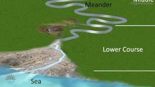
Downstream, the river the descend decreases, which causes the river to have less velocity, which makes erosion less likely. Especially in the lower course of a river, the river has less velocity and erosion is less likely to occur. The speed of the water flow decreases, which causes the eroded material to sink to the bottom. This process of sinking is called sedimentation.
Compare this with fruit juice: When the bottle has stood still for a while you see the heavier ingredients sink to the bottom. To mix all ingredients, you often have to shake before use!
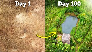
Sedimentation is important for countries which are close to the sea, like the Netherlands. This country is made up by a huge layer of sediment that is eroded upstream. If this had not happened, the Netherlands would have been a lot lower, so that it would have been flooded by the sea.
Because rivers in the lower reaches of the river often split into all kinds of branches, we call this the river delta. These branches together have the shape of a triangle, which looks like the Greek letter D, which is called delta. In the river delta a lot of sediments sink to the bottom. These sediments often ensure that the land is fertile, causing high agricultural yields.
So erosion tears down the landscape in the upper reaches of the river, while sedimentation builds the land in the lower reaches of the river.