Event Based Fire Hotspot Analysis and Mapping using NASA FIRMS Data and GIS

Fire hotspots are locations that has has higher concentration of fire events
compared to expected number given a random distribution of fire events.
Fire Hotspot Analysis is necessary to identify such hotspots that will be beneficial
for managing fire induced disasters.
The fire hotspot analysis and mapping in GIs involves following steps in Sequence
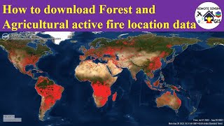
1) Download data from FIRMS archive https://firms.modaps.eosdis.nasa.gov/...
2) Import data and make a copy (if necessary)
3) Integrate nearest fire events with threshold distance value
4) Collect Events using Spatial Statistics Collect events tool to identify nearest
incidence count
5) Test for clusters for collect event dataset using Analyzing Pattern tool and Spatial autocorrelation (Moran's I Statistics)
6) Map the clusters using Getis Ord GI or any convenient tool under spatial statistics tools
7) Interpolate the zscore from the cluster map using IDW method to create surface representing hotspot
8) Use adequate reclassification technique and make map layout of final hotspot map