Exploring the Power of Inset Maps

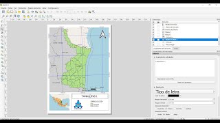
Inset maps, also known as supplementary maps, play a crucial role in providing additional context and detail within a larger geographic context. These smallerscale maps are typically positioned within a larger map, offering viewers a closer look at specific areas of interest. Inset maps are invaluable for highlighting intricate geographical features, urban areas, or points of interest that might be overlooked on the main map. This video explores the significance of inset maps in enhancing spatial understanding and navigating complex geographical data.
Thanks for watching it.
Original Credit: Prof. Stephen Metts
Please like, share, and subscribe to this channel.
YouTube: / 7startech95
Facebook: / 7startech95
Instagram: / 7startech95
Twitter: / 7startech95
Blog: https://www.7startech95.blogspot.com
LinkedIn: / 7startech95
Contact us at:
[email protected]
#gis #qgis #insetmaps #7startech95